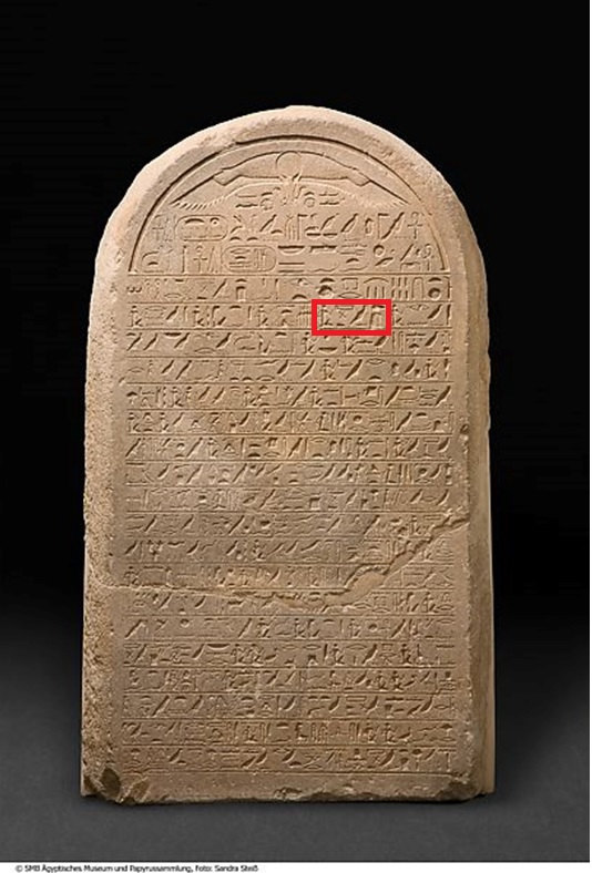
This week, we will be discussing those boundary stelae established to mark inter-polity boundaries, building on last week’s discussion of those boundary stelae used to delineate fields or mark internal administrative boundaries. Previously, we concluded that often times the materiality and placement of these stelae were crucial as ways in which power could be dramatically staged. At times, this may have been just as important as the specific territorial claims recorded on the stelae themselves. As we shall see, this largely holds true when considering inter-polity boundary stelae as well!
There are very, very few inter-polity boundary stelae known from Pharaonic sources—at least during the Middle Kingdom and New Kingdom. To my knowledge, the corpus consists of a series of boundary stelae established by Senwosret III near Semna Gorge in his 8th and 16th regnal years, rock cut stelae etched in boulders at Kurgus during the reigns of Thutmose I and Thutmose III (which reference complementary examples on the northeastern frontier, somewhere near the Euphrates), and a stela dedicated by Seti I near Kurkur. It is quite likely that there were other examples, now destroyed or still undiscovered. Not unlike the Amarna boundary stelae, there are numerous examples of rulers dedicating stelae in frontier regions, but many of these refer to the act of establishing a tash (or other valiant royal actions) rather than setting a specific boundary. It is striking that establishing boundary stelae does not seem to have been a required part of Pharaonic border maintenance—and indeed, perhaps not coincidentally those kings who did dedicate such stelae are among the most warlike known from these periods. At the edges of the Pharaonic world, these kings dramatically staged their power by dedicating royal stelae at prominent local landmarks. In the case of the Kurgus stelae, it is notable how these Pharaonic carvings obliterated local rock art—the meaning seems unlikely to have been lost on those who lived nearby! Just as with agricultural or administrative boundary stelae, it was the intervention in the landscape that mattered at least as much as the specific dimensions of the lands that were claimed. After all, in theory, (though very much not in actual practice), the pharaoh could simply remake or alter such boundaries according to his whims.

Royal action established such tashu-boundaries, and as such they were hardly permanent features. Tashu were the consequence of specific actions undertaken by specific kings. Thus, such boundaries are not infrequently described in the first person—in his year 16 stelae from Semna and Uronarti, Senwosret III declares “ I have made my boundary, out-southing my forefathers” and “as for any son of mine who makes firm this boundary my incarnation made, he is my son, born of my body.” For Egyptian royalty, boundaries were often a very personal manner—Senwosret III’s boundary was not necessarily that of future rulers, who could establish their own tashu .
This is a key distinction from modern boundaries and territoriality: we are conditioned to think of political borders as linear and unchanging—in fact, one could argue that one of the primary roles of many international organizations is to safeguard national sovereignty and keep borders roughly as they are at present. Borders may always be produced and reproduced through historical processes, but lots of work is done to present them as eternal and unchanging, even when the reality is that many modern borders were either drawn unilaterally by colonial powers or altered dramatically through violent conflict. In Pharaonic Egypt, one could argue that the nome system in part functioned unify the lands between the Mediterranean and the First Cataract as an inviolable unit, but the actual inter-polity boundaries that were established were often viewed as specific to the kings who made them, precisely because tashu were so intimately connected to royal action.
For the Borderscape Project’s period of study, boundary stelae were not used to mark inter-polity boundaries. In fact, one can view such installations, whether by Senwosret III in the Second Cataract, Thutmose I and III at Kurgus, or Seti I at Kurkur, as the culmination of a story that begins with the foundation of the Pharaonic state, when elite members of this polity first began drawing real distinctions between the peoples of Nubia and Egypt—if only because the environmental realities of the First Cataract meant it was significantly more challenging to extend the hegemony of this state south of these rapids. Boundary stelae were one form that later kinds of boundary maintenance took—in the coming weeks we will investigate a variety of other examples, from fortress construction and surveillance to trading expeditions.
Bibliography
Darnell, J. “A Stela of Seti I from the Region of Kurkur Oasis.” In S. Snape and M. Collier, eds., Ramesside Studies in Honour of K.A. Kitchen. Liverpool: Rutherford Press Limited, 2011: 127-144.
Obsomer, C. “Sésostris III et la frontière de Semna: une analyse des stèles nubiennes de l’an 16.” BABELAO: Bulletin of the Belgian Academy for the Study of Ancient and Oriental Languages (2017)6: 1-38.
Davies, W.V. “Nubia in the New Kingdom: The Egyptians at Kurgus,” in Nubia in the New Kingdom: Lived Experience, Pharaonic Control and Indigenous Traditions ed. N. Spencer, A. Stevens, and M. Binder, 65-105. Leuven: Peeters, 2017.

